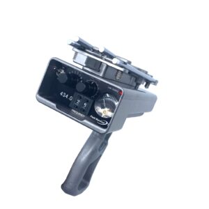


Description
Models: Turbo GPS
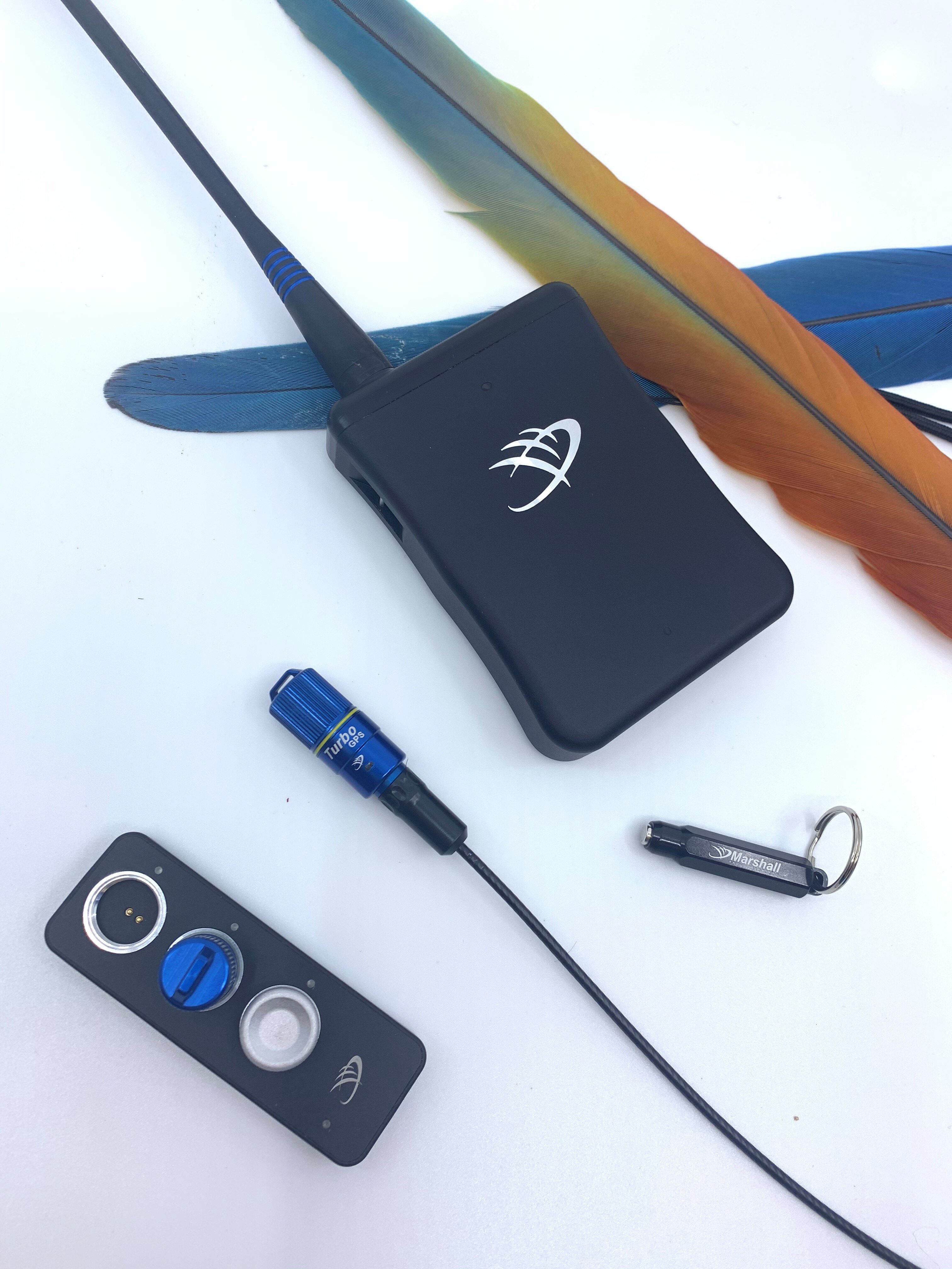
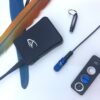
The Turbo-GPS transmitter is the same size, shape and weight of our RT transmitters, but inside we found a way to incorporate a tiny GPS receiver. The Turbo-GPS learns where it is and then sends this data via radio frequency to a transceiver we call the Pocketlink. It is the PocketLink that in turn forwards this situational data it is receiving to our App on your iPhone or iPad via Bluetooth. At the same time, the Turbo-GPS is sending a beeping signal in the UHF band that can be received by the Field Marshall for regular direction-finding.
When the transmitter stops hearing from the PocketLink it automatically kicks on the Turbo after 30 seconds of no contact. This allows 2-3 times the range with very little impact to battery life making it capable of sending the GPS signal great distances using situational awareness and intelligent response. When the transmitters hears from the PocketLink again it will automatically turn off the Turbo Mode.
For more difficult terrain, urban like areas, high wind conditions and areas that are challenging for recovery we recommend using the Turbo GPS model.
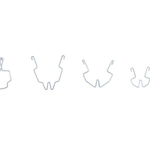
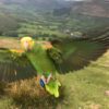
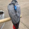
MOUNT OPTION
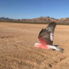
We recommend the tail option for optimal GPS positioning for your Parrot. Our Tail Mount option will come with two tail feather pieces and an installation tool. To learn more about how to install a tail feather piece you can follow the link. Tail Feather Piece Installation Kit
For Correct Sizing please include in notes the type of bird you are flying.
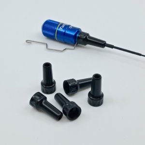
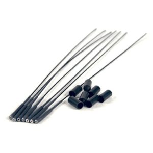
ANTENNA AND ANTENNA PROTECTOR
The GPS transmitters and system come with the standard set up which includes a regular antenna and antenna protector. These are great for smaller parrots or Macaws with mellower temperaments. For larger Macaws, multiple macaws and those who practice At Liberty flying we recommend the Upgraded option which includes a “heavy”/thicker antenna and a machined aluminum antenna protector. The aluminum antenna protector can resist the powerful bites of larger macaws. These metallic antenna protectors however may slightly reduce satellite signal reception up to 20%.
GPS BATTERY LIFE
The user configurable modes available within AeroVision allow the Turbo GPS to run for up to a week on the rechargeable battery. Mixed mode use can be configured for several hours of high update GPS plus many hours of lower update rate tracking. Default settings the battery life is 2-3 days.
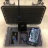
GPS Transmitter
- Weight: 9 grams with battery installed
- Battery used: rechargeable Lithium Battery (user swappable)
- Battery Life: 2-3 days with configurable modes to allow up to 7 days
- Antenna: 7 inch end-fed dipole diplexed with GPS
- Turbo GPS Range: 2 to 100 miles*
*Measurements of distance are quoted using an Omni antenna. Conditions are variable depending on terrain and obstacles.
POCKETLINK BATTERY LIFE
The rechargeable lithium battery in the PocketLink lasts for 30+ hours, and is charged via a micro USB port. Since the battery has built in intelligence, there is no “memory” and you can also leave it plugged in to the vehicle at all times to stay “topped-off” and ready to leave if needed.
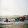
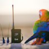
PocketLink
- Weight: <12 oz
- Battery used: 3.7V LiPo internal (rechargeable through Micro USB cable provided)
- Battery life: 30+ hours
- Antenna connection: SMA
- Range: up to fifty (50) feet via Bluetooth LE to iOS device
- AeroVision Mapping App
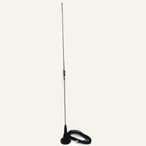
ADD AN OMNI TO YOUR SYSTEM
The PocketLink uses an SMA connector for quick attachment to Marshall’s UHF Omni antennas. In addition, the GPS system comes with a special SMA-SMB adapter cable that allows the UHF Yagi on your Field Marshall UHF receiver to be used to boost range while on foot in the field.
DEVICES TO USE WITH YOUR SYSTEM
AeroVision App on iOS (downloadable from App Store) requires:
- iPad Mini: Gen 5 or newer (cellular enabled)*
- iPad 6th gen or newer (cellular enabled)*
- iPhone: 11 and newer
AeroVision Beta App on Android (downloadable from Google Play Store) versions supported: Android 10 / Android 11
Designed to run on higher-end phones and tablets, specifically models with speedy processors, internal GPS, internal magnetometers (compass), BTLE connectivity, and running one of the latest versions of Android OS (9/10/11)
Officially Supported Devices
- Google Pixel (2, 4, 4a, 5)
- Google Nexus Tablet
- Samsung Galaxy (S7-S10, S20, S21)
- Samsung Galaxy Tab S2
Many other devices may also work great, but are not supported by our team.
* Note: Apple and Android products are not sold by Marshall Radio. Also important: a cellular enabled tablet is required in order for it to have the needed GPS functions. However, you do not need to enable the cellular data plan to use AeroVision.
** Latest edit of compatible devices 5.25.21
RECOMMENDED ITEMS TO ADD TO YOUR SYSTEM
- Field Marshall UHF receiver
- UHF Turbo/RT/ or Micro (recommended as the secondary backup transmitter)
The Field Marshall Receiver allows you to track the beeping signal of your GPS transmitter or when you are in “Plan B Mode” the UHF receiver is needed to track your backup UHF regular telemetry transmitter.
The difference between our GPS system and other GPS devices for falconers
Four main ways, in combination:
- The size is less than half. This means it can be used as a leg or tail mount where other designs are far too large.
- The method is a direct connection, not dependent on nearby mobile towers, so it can be used anywhere without fear of “dead zones.” There is no SIM card to buy, therefore no waterproofing issues or further costs from text requests, etc. required to operate it. Simple. Reliable.
- Instead of periodic updates, delayed or irregular response to text inquiries this is real-time data streaming. You see where you bird is now, not just where it was.
- Our own innovative custom mapping application developed in-house makes it a joy to watch the flight, not a distraction. And you can also Replay or Share your flights (the same tracks and stats) with friends.
These key features have not been available until now.
“Why does the Marshall Radio GPS not take advantage of the mobile network? Wouldn’t that give it unlimited range (theoretically)?”
Well, yes, in fact. And over the last few years there have been several mobile network-based transmitters developed and already out there and they’ve done a good job in many ways.
But we asked ourselves, “Why is it that nobody uses them?” Falconers in Europe and the Gulf who have used SMS-based designs and don’t like them tell us it’s a combination of things:
- They are very large in size and weight, so they must use a backpack
- You have to stop and send text requests and get intermittent updates, and some don’t come for several minutes, if at all
- Even in supposedly good areas, there are dead-zones in service where nothing can be sent or received
- Ones they were using had awkward implementations of mapping, if any at all
- Case designs are not up to the expected standard (not crush proof, waterproof, etc.)
So we thought: “How about we design and build something exciting that falconers would really want to use? We’ve been at this game 18 years now, and think we have a good idea as to what that might be!”
For GPS to be widely accepted by falconers, we knew it would have to be much much smaller, and ideally, the same size as a regular falconry transmitter so it could be tail or leg-mounted in a proven waterproof case design. It would need a full-featured but simple mapping application for mobile devices to which live tracks could be laid down from real-time data streaming (first iOS, then Android), another part of the experience not possible through texting or available to falconers up till now.
And after a lot of effort we worked this out; but what we didn’t anticipate was how our whole paradigm shifted. What we discovered through a season of constant field use was that this was no longer to be understood as just a recovery device, it’s actually an amazing extension of your vision when the bird is out of sight, in real-time as it is happening. And that’s what changed everything for us as users. It was addicting.
So when we said in the announcement video: “does not depend on mobile service,” to us that was an important feature, not a limitation. Our customers hunt in areas around the world where mobile service is intermittent or non-existent and it cannot be counted on for the reliable live-steaming GPS experience. This new design works all the time, anywhere on earth, both in developed countries as well as the remote regions our customers go to hunt.
As the first wave of falconers are able to experience it for themselves this fall, just as we did last season, we’ll see if they also get addicted like we did, indicating we were right in choosing this strategy.
(this is not to say that a mobile-based design for a 2-4 month hacking transmitter will never be done someday, as that could really be cool)